Stakeholder Consultative Workshop for developing a GIS Knowledge base for Ministry of Agriculture Animal Industry and Fisheries held at Ridar Hotel, Kampala – Uganda
Introduction
To develop a Geographic Information System (GIS) Knowledgebase for
MAAIF, a stakeholder a consultative workshop was organized to assess GIS data
availability and needs in the different MAAIF sub-sectors. Thereafter a
field data exercise would be organized to collect geographic location
information for the Agriculture Cluster Development Project interventions
implemented.
The objective of the consultative workshop was to;
- - Assess
the availability of GIS data.
- - Assess
the data needs if the different MAAIF sub-sectors.
- - Create
a common understanding of GIS principles.
- - Assess
the capacity to use GIS techniques.
What is Geographical Information Systems (GIS)?
A geographic information system is a framework for gathering, managing
and analyzing data. Rooted in the science of geography, GIS integrates many
types of data. It analyzes spatial location and organizes layers of information
into visualizations using maps and 3Ds scenes. With this unique capability, GIS
reveals deeper insights into data, such as patterns, relationships, and
situations helping users to make smarter decisions. GIS applications are
tools that allow users to create interactive queries, analyze spatial
information, edit data in maps, and present the results of all these operations.
The system is designed to capture,
store, manipulate, analyze, manage, and present spatial or geographic data. GIS also
sometimes refers to geographic information science (GIScience), the
science underlying geographic concepts, applications, and systems.
Conceptual mode of a GIS has two basic layers; (1)
GIS layer and the (2) the real world.
The objective of the consultative workshop was to;
- - Assess
the availability of GIS data.
- - Assess
the data needs if the different MAAIF sub-sectors.
- - Create
a common understanding of GIS principles.
- - Assess the capacity to use GIS techniques.
What is Geographical Information Systems (GIS)?
A geographic information system is a framework for gathering, managing
and analyzing data. Rooted in the science of geography, GIS integrates many
types of data. It analyzes spatial location and organizes layers of information
into visualizations using maps and 3Ds scenes. With this unique capability, GIS
reveals deeper insights into data, such as patterns, relationships, and
situations helping users to make smarter decisions. GIS applications are
tools that allow users to create interactive queries, analyze spatial
information, edit data in maps, and present the results of all these operations.
The system is designed to capture,
store, manipulate, analyze, manage, and present spatial or geographic data. GIS also
sometimes refers to geographic information science (GIScience), the
science underlying geographic concepts, applications, and systems.
Conceptual mode of a GIS has two basic layers; (1)
GIS layer and the (2) the real world.

How is the Agriculture Cluster Development Project integrating GIS?
ACDP is a 6-year project (2017 - 2022) implemented by MAAIF with support
from IDA /World Bank. The Development Objective of the project is “To
raise on-farm productivity, production, and marketable volumes of selected
agricultural commodities in specified geographical clusters”. ACDP
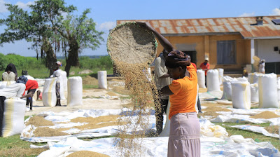
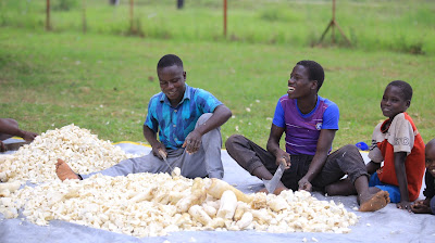
targets 5 commodities which include; Maize, Rice, Beans, Cassava and coffee.
The core beneficiaries are smallholder farmers, and other value chain actors at
the local, district and national level. These include 450,000 farmers drawn from
approximately 300 Area-based Commodity Cooperative Enterprises representing
about 3,000 Rural Producer Organizations.
ACDP is implemented under 4 components and 12 sub-components;
Component 1: Support for Intensification of On-Farm Production. This component supports the operation
and management of an e-Voucher System and provision of subsidize to project
beneficiaries for increased access to and use of improved agro-inputs. Capacity
building for beneficiaries and the stakeholders of the supply side of
agricultural input markets. The component has three sub-components as stipulated below;
·
Sub-component 1.1. e-Voucher Program.
·
Sub-component 1.2. Capacity Building for Target
Beneficiaries and Farmer Organizations.
·
Sub-component 1.3. Development of Agricultural Input
Markets.
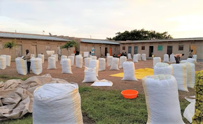
Component 2: Value Addition and Market Access. This component supports activities and
investments to improve the capacities of the Farmer Organisations to manage
post-harvest activities through the acquisition of equipment and development
facilities. In addition, it supports measures to eliminate bottlenecks and
trouble spots in rural access roads critical for the movement of farm produce
to markets and postharvest handling facilities. The component has three
sub-components of:
·
Sub-component 2.1. Capacity Building for Producer Organizations and
Value Chain Actors.
·
Sub-component 2.2. ACCE-level Warehousing, Value addition and Marketing.
·
Sub-component 2.3. Farm Access Roads and Choke Points at Community Level.
Component 3: Policy, Regulatory and Institutional Support. This
component supports the strengthening of the regulatory function MAAIF. This
component also supports preparatory activities (studies) for future investments
in low land irrigation schemes, development of capacity for collection and
management of agriculture statistics and control and management of Fall Army
Worm. The four sub-components are :
·
Sub-component 3.1. Policy and Regulatory Functions.
·
Sub-component 3.2. Agricultural Water Management Investments.
·
Sub-component 3.3. Agricultural Statistics.
·
Subcomponent 3.4. Management of Fall Army Worm.
Component 4: Coordination and Management, and ICT Platform. This component supports the financing
of incremental operating costs for the Project Coordination Unit, Cluster
Multi-Stakeholder platforms and District Coordination Teams to undertake
monitoring and evaluation activities, and impact evaluation studies. The
component is also responsible for developing and implementing web-based,
geo-tagged ICT platforms for learning, knowledge management, and stakeholders’
feedback. The component has three sub-components :
- Sub-component 4.1. National,
Cluster and District Coordination.
- Sub-component 4.2.
Monitoring and Evaluation and Impact Evaluation.
- Sub-component 4.3. Web-based, Geo-tagged ICT Platforms.
ACPD is in the process of establishing a GIS based knowledge base for
storage and accessing of information about the project and the
Ministry. Mapping of ACDP investments include; Farmer groups,
Agro input dealers, Road Chokepoints, Storage Facilities, Processing
facilities, irrigation schemes, UBA agents, highly productive areas, Fall Army
Worm infestation areas, among others.
Examples of sample maps generated out of such knowledge bases include
mapping of Agro-input dealers, dominant soils in Uganda and mapping of other
relevant agricultural information.


Comments
Post a Comment